

Circuit pédestre n°CM9 Les Gorges du Thaurion
Walking, Natural
in Châtelus-le-Marcheix
15.5
km
Loop
on foot
5h
Medium
-
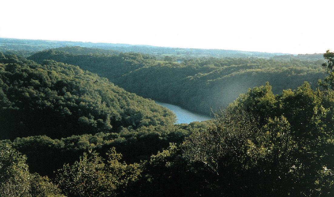
Depart from the Châtelus Le Marcheix inn. Take the D5 (towards Bénévent l?Abbaye). After 350 m, take the first track on the left to walk flat to Villepigue. Go through the village and turn left on the D5 for 200 m, heading for the Thaurion on the Loutre nature trail (purple markings). Follow the path to the Roche-Talamy dam via the Tourtouéroux footbridge. Go past the dam and descend along the lake for 800 m, then up to Saint Aleix by the second path on the left, but you can also go directly...
Depart from the Châtelus Le Marcheix inn. Take the D5 (towards Bénévent l?Abbaye). After 350 m, take the first track on the left to walk flat to Villepigue. Go through the village and turn left on the D5 for 200 m, heading for the Thaurion on the Loutre nature trail (purple markings). Follow the path to the Roche-Talamy dam via the Tourtouéroux footbridge. Go past the dam and descend along the lake for 800 m, then up to Saint Aleix by the second path on the left, but you can also go directly to Saint Aleix by the Pic Noir circuit (purple markings). In the village, take the road on the left. After the last house, take the right-hand track and follow it to the crossroads. 50 m further on, take the right-hand track. Follow the ridge to a reservoir.
- Departure
- Châtelus-le-Marcheix
-
-
Difference in height
- 473.951 m
-
-
-
Documentation
- GPX / KML files allow you to export the trail of your hike to your GPS (or other navigation tool)
-
- 474 meters of difference in height
-
- Maximum altitude : 637 m
- Minimum altitude : 373 m
- Total positive elevation : 474 m
- Total negative elevation : -469 m
- Max positive elevation : 180 m
- Min positive elevation : -147 m