

Circuit pédestre Autour de la voie romaine CC1
Walking, Religious
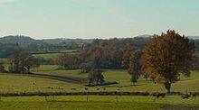
in Chambon-Sainte-Croix
6.7
km
Loop
on foot
1h 45min
Easy
-
Start Rue Claude Monet at the grassy triangle
- Departure
- Chambon-Sainte-Croix
-
-
Difference in height
- 114.333 m
-
-
-
Documentation
- GPX / KML files allow you to export the trail of your hike to your GPS (or other navigation tool)
-
- 114 meters of difference in height
-
- Maximum altitude : 337 m
- Minimum altitude : 232 m
- Total positive elevation : 114 m
- Total negative elevation : -114 m
- Max positive elevation : 50 m
- Min positive elevation : -66 m