

Circuit pédestre : la Tour du Bois Lamy
Walking
in Moutier-Malcard
7.4
km
Loop
on foot
1h 30min
Easy
-
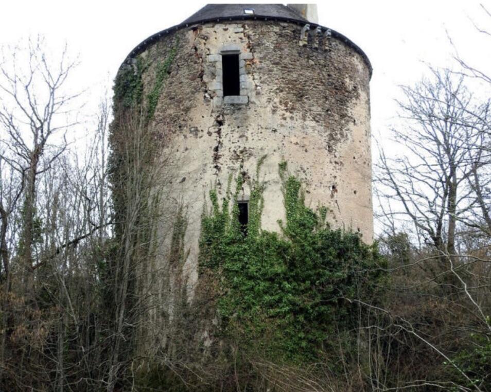
In 1471, Antoine de Blanchefort, Scieur de Bois-Lamy, founded a vicarage in the Moutier-Malcard church.3 feudal castles once stood in the commune: Moutier and Plaid, which have been completely demolished, and Bois-Lamy, of which only the circular keep remains.
Today, Moutier-Malcard is a pleasant rural commune with a school, a grocery store and a café.
- Departure
- Moutier-Malcard
-
-
Difference in height
- 97.3333 m
-
-
-
Documentation
- GPX / KML files allow you to export the trail of your hike to your GPS (or other navigation tool)
-
- 97 meters of difference in height
-
- Maximum altitude : 377 m
- Minimum altitude : 326 m
- Total positive elevation : 97 m
- Total negative elevation : -86 m
- Max positive elevation : 25 m
- Min positive elevation : -41 m