

Circuit pédestre : Les Seigneurs
Walking
in Châtelus-Malvaleix
12.3
km
Loop
on foot
3h 30min
Medium
-
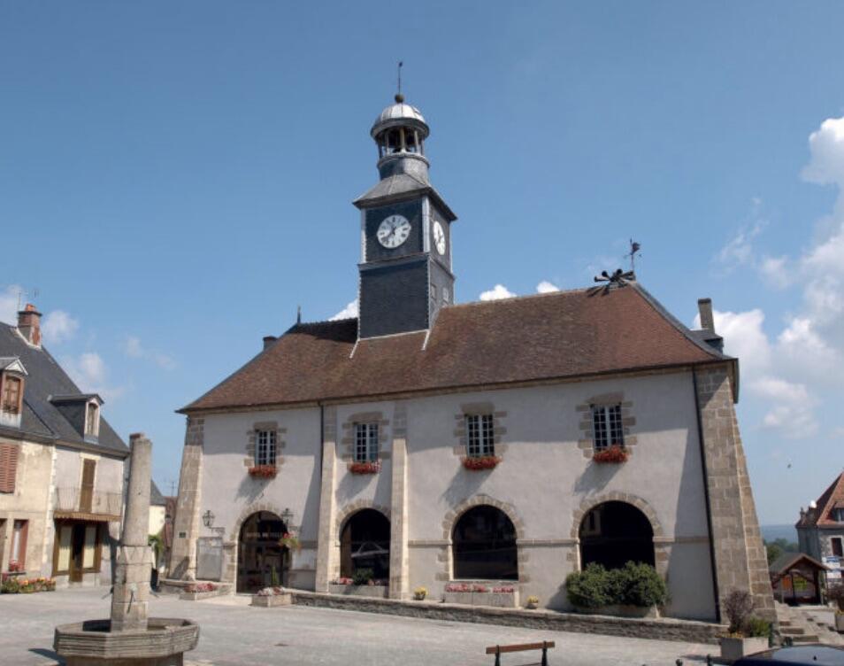
As early as the Middle Ages, the village grew up at the foot of a small fortified castle, "castelucium" in Latin. It was one of the strongholds of the Malval family, hence the name Châteaux-Malvaleix. The town's coat of arms features the arms of three families who were lords before the French Revolution: the Malessets, the Escoubleaus and the La Roche-Aymons. From its past prosperity, Chatelus has preserved a rich built heritage with its remarkable houses, town hall, fountains and...
As early as the Middle Ages, the village grew up at the foot of a small fortified castle, "castelucium" in Latin. It was one of the strongholds of the Malval family, hence the name Châteaux-Malvaleix. The town's coat of arms features the arms of three families who were lords before the French Revolution: the Malessets, the Escoubleaus and the La Roche-Aymons. From its past prosperity, Chatelus has preserved a rich built heritage with its remarkable houses, town hall, fountains and washhouses?
With its two lakes and attractive tourist facilities, the town offers a wide range of shops, public and health services, and a vibrant year-round community life.
- Departure
- Châtelus-Malvaleix
-
-
Difference in height
- 216.667 m
-
-
-
Documentation
- GPX / KML files allow you to export the trail of your hike to your GPS (or other navigation tool)
-
- 217 meters of difference in height
-
- Maximum altitude : 523 m
- Minimum altitude : 390 m
- Total positive elevation : 217 m
- Total negative elevation : -217 m
- Max positive elevation : 102 m
- Min positive elevation : -86 m