

Circuit Trail n°8 : par Monts et Vallons
Trail-running
in Sainte-Feyre
27.0
km
Loop
Running
4h
Hard
-
This loop first takes in circuit n°7 (Les Bois de Sainte-Feyre) and then circuit n°6 (Le Puy de Gaudy).
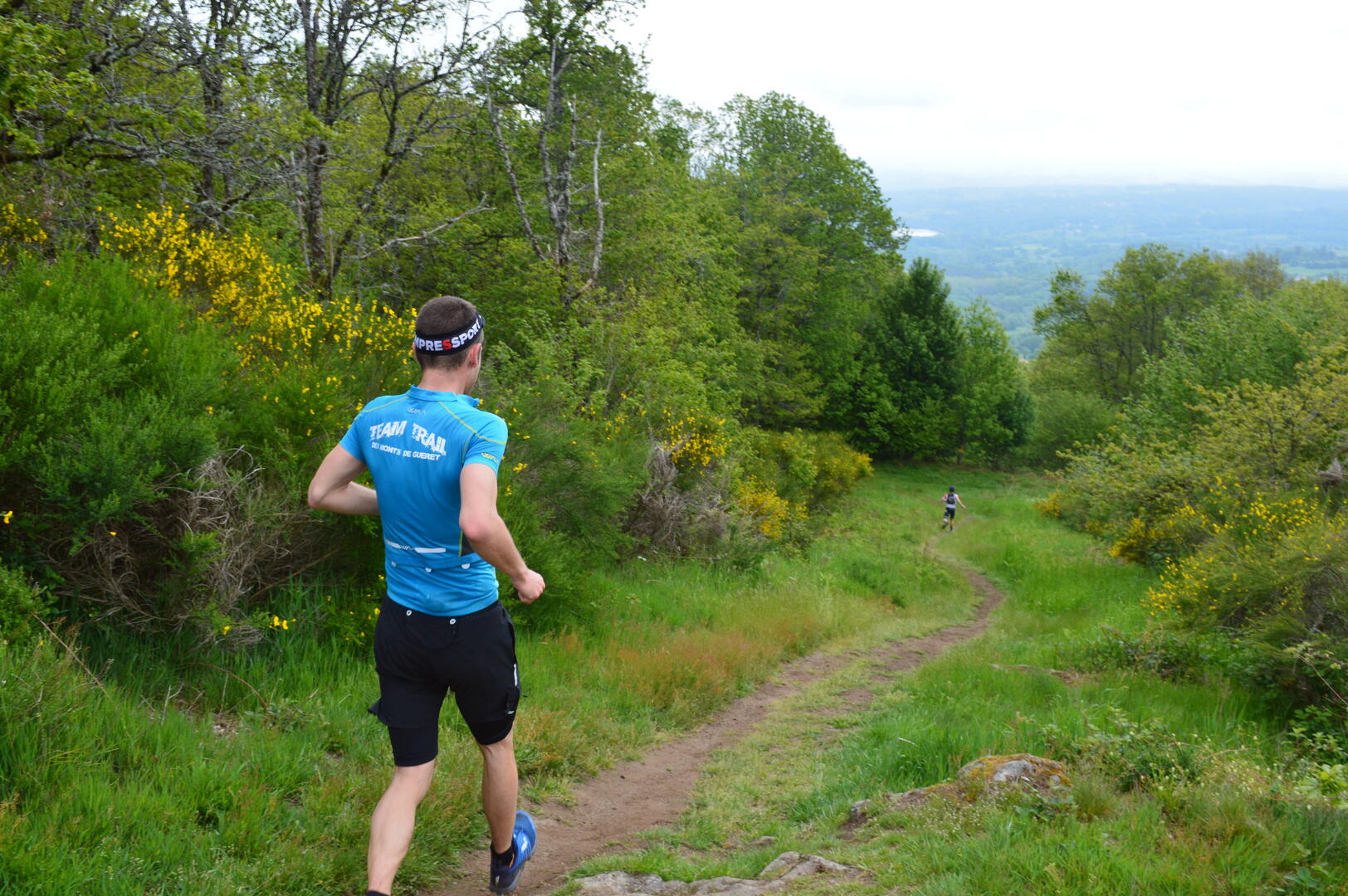
Of the 27 km that make up this trail, only the very first few kilometers are really relaxing... Indeed, after the village of Peyrabout, the circuit becomes a rollercoaster, taking you through beech and fir forests, as well as more open spaces in the Guérande countryside. The trails are varied: tracks, sunken lanes, streams, with the total percentage of road not exceeding 9%. In many...This loop first takes in circuit n°7 (Les Bois de Sainte-Feyre) and then circuit n°6 (Le Puy de Gaudy).
Of the 27 km that make up this trail, only the very first few kilometers are really relaxing... Indeed, after the village of Peyrabout, the circuit becomes a rollercoaster, taking you through beech and fir forests, as well as more open spaces in the Guérande countryside. The trails are varied: tracks, sunken lanes, streams, with the total percentage of road not exceeding 9%. In many places, the view over the east of the Creuse department, and even beyond, is unobstructed. This is certainly a good opportunity to catch your breath.
At the end of a fourth steep climb, you'll find your vehicle near the "Loups de Chabrières".
- Departure
- Sainte-Feyre
-
-
Difference in height
- 943.734 m
-
-
-
Documentation
- GPX / KML files allow you to export the trail of your hike to your GPS (or other navigation tool)
-
- 944 meters of difference in height
-
- Maximum altitude : 676 m
- Minimum altitude : 454 m
- Total positive elevation : 944 m
- Total negative elevation : -944 m
- Max positive elevation : 192 m
- Min positive elevation : -151 m